


Hurricane Lee rapidly intensified at a historic pace into a Category 5 storm Thursday night, adding to a spate of extremely intense hurricanes this year and in recent decades which experts say is a symptom of the climate crisis.
This year alone, Category 5 storms have already appeared in all seven ocean basins where tropical cyclones form, including Hurricane Jova, which also rapidly strengthened into a Category 5 storm earlier this week.
Jim Kossin, a hurricane expert at the University of Wisconsin-Madison and the Brooklyn-based nonprofit First Street Foundation, agrees. He cautions the NOAA database had not fully counted storms prior to the satellite era, and while advances in technology have made it easier to measure hurricanes, it is still difficult to determine the real trend.
Still, he said at the breakneck pace at which the oceans are warming, high intensity tropical cyclones are likely occurring more often.
The primary way in which storms reach Category 4 or 5 strength is by undergoing a rapid intensification process — when a storm’s winds strengthen rapidly by at least 35 mph in 24 hours or less, said Reed.
It’s just one of the ways experts say the climate crisis is making hurricanes more dangerous, as warmer waters allow for storms to strengthen quicker and reach higher categories on the hurricane wind speed scale. More than 90% of warming around the globe over the past 50 years has taken place in the oceans, according to the National Oceanic and Atmospheric Administration.
“The short of it is, as the sea surface temperatures warm, because of human-induced greenhouse gas emissions, the likelihood that any event will undergo rapid intensification will increase,” Reed said.
Rapid intensification has been happening more and more as storms are approaching landfall, making them harder to prepare for. Hurricane Idalia rapidly intensified by 55 mph in 24 hours before landfall along Florida’s Big Bend as a Category 4 hurricane late last month.
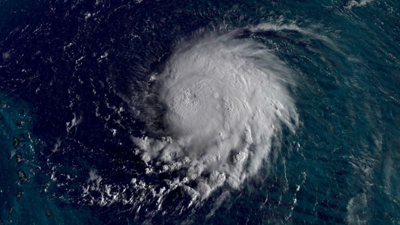
And in the North Atlantic, where ocean temperatures have been off the charts, storms like Lee have had quite a feast.
Lee’s winds increased 85 mph in 24 hours, the third-fastest a storm has rapidly intensified on record in the Atlantic Ocean, according to NOAA research meteorologist John Kaplan.
“There is little doubt that the exceptionally warm ocean waters we’re seeing have a human fingerprint on them,” Kossin said. “Add to this the warming effects of the El Niño happening this year and we have a recipe for breaking a lot of temperature records.”
Kossin noted this is especially true in the eastern North Pacific, where warming from a growing El Niño is most concentrated. “Jova is sitting in the middle of this, and the warm water certainly fueled the rapid intensification,” he added.
One thing is for certain: As the world’s oceans continue to warm, experts say the frequency at which these top-of-scale storms can occur and intensify will only increase.